


Voting District 0021, Montgomery County, Texas
About
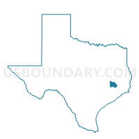
Outline

Summary
| Unique Area Identifier | 675949 |
| Name | Voting District 0021 |
| County | Montgomery County |
| State | Texas |
| Area (square miles) | 3.19 |
| Land Area (square miles) | 3.18 |
| Water Area (square miles) | 0.01 |
| % of Land Area | 99.65 |
| % of Water Area | 0.35 |
| Latitude of the Internal Point | 30.31565910 |
| Longtitude of the Internal Point | -95.49254380 |
Maps


Graphs
Select a template below for downloading or customizing gragh for Voting District 0021, Montgomery County, Texas


Neighbors
Neighoring Voting District (by Name) Neighboring Voting District on the Map
- Voting District 0027, Montgomery County, TX
- Voting District 0040, Montgomery County, TX
- Voting District 0044, Montgomery County, TX
- Voting District 0051, Montgomery County, TX
- Voting District 0073, Montgomery County, TX
Top 10 Neighboring County Subdivision (by Population) Neighboring County Subdivision on the Map
Top 10 Neighboring Place (by Population) Neighboring Place on the Map
Top 10 Neighboring Unified School District (by Population) Neighboring Unified School District on the Map
Top 10 Neighboring State Legislative District Lower Chamber (by Population) Neighboring State Legislative District Lower Chamber on the Map
Top 10 Neighboring State Legislative District Upper Chamber (by Population) Neighboring State Legislative District Upper Chamber on the Map
Top 10 Neighboring 111th Congressional District (by Population) Neighboring 111th Congressional District on the Map
Top 10 Neighboring Census Tract (by Population) Neighboring Census Tract on the Map
- Census Tract 6937, Montgomery County, TX (6,834)
- Census Tract 6933, Montgomery County, TX (6,565)
- Census Tract 6935, Montgomery County, TX (5,633)
- Census Tract 6934, Montgomery County, TX (4,252)
- Census Tract 6938, Montgomery County, TX (3,728)
- Census Tract 6936, Montgomery County, TX (2,878)